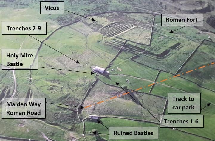
In September and October 2017 we ran test pit excavations to inform our understanding of the context of the Roman Fort and begin to unpick how the site has been used in the centuries since the Roman occupation.

Trenches 1 – 6 were in an area we suspected has a “good depth of time” here. This area is sandwiched between the south eastern fort ramparts, Holy Mire Bastle (a ruined medieval farmstead) and the Maiden Way Roman Road . The geophysical survey showed up anomalies which we wanted to investigate. These possible enclosures are overlain by rigg and furrow ploughing, so we thought there may be different layers going back into several historical periods.

Trenches 7 -9 were located so we could examine the area of suspected ‘parade ground’, including a section of the bank surrounding the area identified by Stewart Ainsworth in the English Heritage survey. The English Heritage report explained that parade grounds are to be expected, but few have been identified in Britain:

The report goes on to describe why this area might be the location of Epiacum’s parade ground:

So what did we find? Click on the link to download a pdf of the report of the excavations written by Dr Rob Young.
NB – We opened up more trenches than we first thought, so the numbers in the pictures above don’t match the ones in the report!
Epiacum Test Pitting Report 2017 (3.5Mb)
And here is Dr Rob, back in October, summing up the excavations and everything we discovered!
